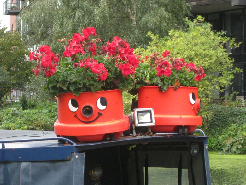
Only four years after the Regents Canal was opened a bill was presented to Parliament to authorise the construction of a link to the River Lee Navigation. The River Lea, which rises in the Chiltern Hills and flows into the Thames at Bow Creek, always formed something of an obstacle to travellers and carriers. A crossing point may have existed long before the first century AD but archaeologists have revealed the definite existence of a Roman settlement on the road between London (Londinium) and Colchester (Camulodonum).
In the medieval period a triple arched, stone bridge was constructed over the Lea at Bow, because, so the story goes, Queen Matilda, wife of Henry the First, was soaked in an unfortunate incident when she was crossing the river. This made a road journey safer at that point but the Lea continued to present problems because the river split into several meandering channels in its lower reaches. These channels, which were utilised as a power source for water mills, became known as the Bow Back Rivers. During the C18th a great deal of work was undertaken in improving the lower reaches of the Lea but the opening of the Regents Canal provided an opportunity to use an alternative route between the Thames and the Lea Valley. Generally speaking the term Lee is used when referring to parts of the river that have been canalised or officially improved for the purpose of navigation, the first Act of Parliament referring to this dating from 1425.
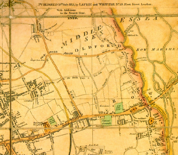
The map shown to the right (1) is part of one published by Laurie and Whittle in 1813 and updated in 1819. The line of the Regents Canal is shown in yellow entering from the left and running down to Mile End Road. A bridge was built close to Saville Row, which was a terrace of houses, and from there the new waterway would run down to Limehouse. The River Lea was about half a mile from Saville Row and given the importance of that river as a transport conduit it is not surprising a link between the new canal and the river was proposed soon after the Regents was completed. An Act of Parliament was obtained by Sir George Duckett and the link, named the Hertford Union Canal, was opened in 1830.
Sir George actually had greater ambitions than just building a connection between the Regents Canal and the River Lea. He already owned the Stort Navigation, a thirteen mile and six furlong (there are eight furlongs in a mile for those who have forgotten or don’t go to the races) canal which linked Bishops Stortford with the River Lea at Hoddesdon. In 1824, as he was preparing to submit plans for parliamentary approval of the Hertford Union, he wrote to the Earl of Hardwicke, an influential peer, outlining a plan for a canal to link Bishops Stortford with Cambridge. As Cambridge was connected to Kings Lynn by the River Cam and the Great Ouse realisation of this idea would mean Limehouse would be linked through a thread of six navigable waterways to a port on the Norfolk coast.
If Sir George had the money or if the Earl had offered to back it financially then perhaps the plan would have come to fruition but as neither were in prospect Duckett suggested that the Regents Canal Company might be interested. However, in the 1820s, subscribers to a project only saved from collapse by the organisational and negotiating skills of the Chairman, Colonel John Drinkwater, would, surely, have been more interested in seeing a return on their investment rather than pouring more capital into a new venture no matter how attractive it might look on paper. The days of Canal Mania were long gone.
From the start the Hertford Union was not a consistent commercial success but eventually much of the south bank, and, to a lesser extent, parts of the north bank, were lined with all kinds of industrial enterprises. These were well served by the waterway. A huge amount of timber, sometimes brought thousands of miles across the oceans, eventually ended up in the saw mills and veneer works along the canal, which was often called Duckett’s Cut or simply the Cut (a name which I will now mostly use).
Today the Cut is unrestrictedly fed by water from the Regents Canal, but initially the Regents Canal Company ensured that there would be no unauthorised encroachment on its resources. Canal companies were, understandably, very jealous of their water supplies and the parliamentary Act under which the Cut was built stipulated the ‘summit level of this canal is to be 6 inches above the top water mark of the Regents Canal’. Consequently, even though Duckett’s canal was only a little over a mile long it originally had its own small reservoir and a steam engine was used to pump water from the lower pound back to the upper level.
On descending to the towpath you may see the remains of gates used to close the Hertford Union off from the Regents. They are long disused but initially there was what was called a double cistern lock here which had four oak gates that could be set to ensure the required difference in the water levels between the Cut and the Regents was maintained. Setting off along the towpath will take you past Bow Wharf (2) on the opposite bank, where a series of enterprises are housed in either wooden units or industrial buildings converted for social, leisure and exercise use. At the moment there are plans afoot for further development of the site which has been opposed by a number of organisations including the local neighbourhood forum. Click here to read details of the planning proposals that were turned down by the local council in December of 2025 and an update on what has happened since.
The modern residences on the towpath side of the Cut were constructed on a strip of land between the canal and the back of a terrace of houses built in the C19th. These houses were also designed to take in the view, in this case of Victoria Park. The park was laid out a few years after completion of Sir George Duckett’s enterprise, and as the Regent’s Canal defined the western border for James Pennethorne’s park plans, so the Cut defined a good deal of the southern perimeter. The houses in the terrace were, and still are, attractive, and one was, for a time, the home of Israel Zangwill.
Israel Zangwill was the son of immigrants from Latvia and Poland, which at that time were within the Czarist Empire. Born in 1864 in London’s East End, he considered himself a ‘Jewish Cockney’. After working as a teacher and a journalist he achieved success as a novelist and playwright, drawing on his youthful experiences in Whitechapel and Spitalfields. He found international fame with the publication of ‘Children of the Ghetto’ in 1892. Only a couple of miles from Whitechapel, life in the relatively grand house facing Victoria Park must have been something of a contrast to the conditions which faced most East Enders of the period, but Zangwill never departed emotionally from his roots. No doubt he would have walked over Grove Road bridge on some days and looked down on the activity in the Cut, which would have been a constant reminder of how the drive of late Victorian industrialisation depended on long hours of grinding, heavy, manual labour. Always politically active Zangwill gave support to those whom he considered oppressed and exploited. He was, for example, a founding member of the ‘Men's League for Women's Suffrage’. In 1903 he married Edith Ayrton who herself was a writer. Her book ‘The Call’ was published just a century ago and deals with the difficulty women found in being accepted as scientists and the Suffragette movement too, but is not all about struggle - it also has a romantic theme.
If you want to see the blue plaque that marks the Zangwill residence walk under Grove Road bridge, climb the steps on the left and then cross the zebra crossing. Turn right and follow the footpath round to the left to 288 Old Ford Road (Edith Zangwill is not mentioned on the plaque but I don’t think she actually lived in this house).
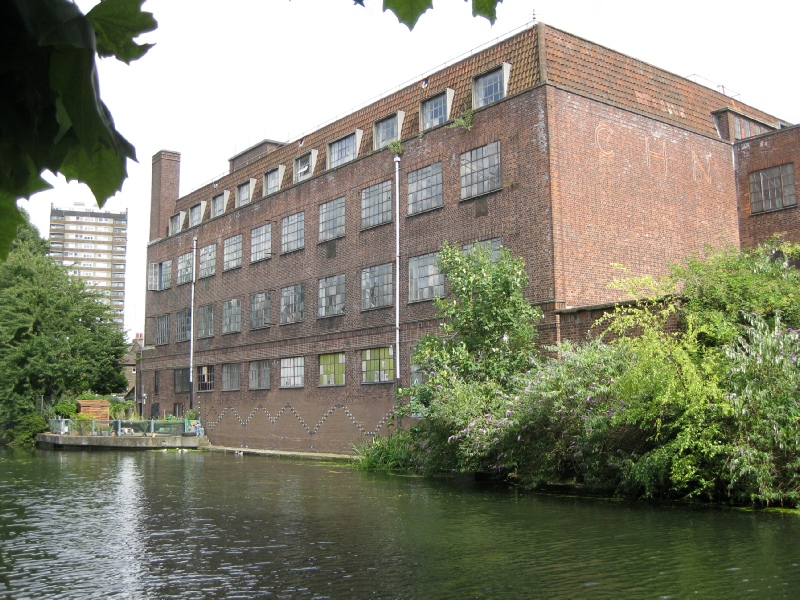
It is not only a commercial gym and a banqueting suit which have utilised the old industrial buildings on the Cut. As you pass under Grove Road bridge, hard by a modern residential development on the south bank, you will see a derelict redbrick building, with smashed glass panes in the windows frames. This abuts another, in a better state of repair, which has CHN on the side (3). In their heyday these buildings were linked to the veneer trade. CHN stood for CHN Veneers, which had been established by an entrepreneur named Morris Cohen in the 1930s. Perhaps surprisingly the factory was expanded and rebuilt in the middle of the Second World War, but this was to facilitate the production of war material, including propellers and plywood for the de Havilland Mosquito, a fast twin-engined aircraft that was constructed almost entirely of wood. When the war was over veneer production continued in what was called the Chisenhale Works, until the 1970s. In that decade there was something of a revival of brewing in London and for a period after the closure of CHN barrels of Godson’s Black Horse bitter might have been seen being loaded into barges adjacent to the defunct factory. The brewery did not stay long, however, and in the 1980s the Chisenhale Works became an arts centre with studios for dancers and artists. Well known just as the Chisenhale, it is still used in this way today but it is not clear how long this will continue. Once again the website of the local neighbourhood forum is the best source of information, so click here if you want to read informed opinion.
Hertford Union Canal


This page 1 of 5
1
2
3
Flowering fun 2020
The speeding bike 2018
ice

When London Became An Island