During the time when the Cut was an important sinew in London’s canal network industrial wharves stood along this bank of the canal. One served the small arms industry which is why the road leading to Three Colts Bridge came to be called Gunmakers Lane. Gunmaking was established on adjacent land in 1866, a significant date in rifle development. Much of the credit for the victory of the Prussian Army over the Austrians in that year was due to the use of the needle gun, a kind of breech loading rifle far superior to the old-fashioned muzzle loader. For many years this type of weapon was commemorated in a nearby pub on Roman Road, called the Needle Gun. Here, presumably, knowledgeable workers could drink as they talked shop and gave their opinions on the latest development in armaments. No heritage plaque ever graced the front of the Needle Gun (although the building remains) but close to the junction of Roman Road and Gunmakers Lane is one which commemorates another pub, The Gunmakers Arms, although it is on the wall of a modern block of flats.
The Gunmakers Arms was no longer being used as a pub when, in 1915, it was bought by the pacifist Suffragette leader Sylvia Pankhurst and renamed the Mother’s Arms. There was then a radical change of use as it became a kind of welfare centre, the East London Federation of Suffragettes setting up a baby clinic, staffed by trained nurses and a crèche. The childcare provision was of immense benefit to women who could then take the opportunity to take paid employment, meagre though the wages might be. Click here to find out more about the Suffragettes in this part of the East End, an area of London so different to that described in Edith Zangwill’s ‘The Call’. A fine picture of Sylvia Pankhurst may be seen on the gable wall of the Lord Morpeth pub (1) in Old Ford Road.
The arms factory itself, which mostly produced rifles, was owned by the London Small Arms Company. Its main competitor was based in Birmingham. Although the quality of the LSA guns were prized, the company was never able to complete in quantity or to diversify because of restriction on space. Consequently, there are no LSA bicycles or fabulous cafe racers like the Birmingham Small Arms Gold Star. Around the time LSA was wound up in the 1930s BSA was progressing to be the largest producer of motorcycles in the world. Indeed the company was arguably the largest company on the globe at one stage but this did not stop it from going bust in the early 70s. It was not too big to fail.
The canal side walk has no reminders of the arms industry but after a few yards you will come to a metal sculpture part of which clearly represents a horse. The sculpture is called The Barge of Invisible Memories and a notice, which has now disappeared, explained that it is a symbolic representation of the history of the East End. Should you like to read the text of the notice click here.
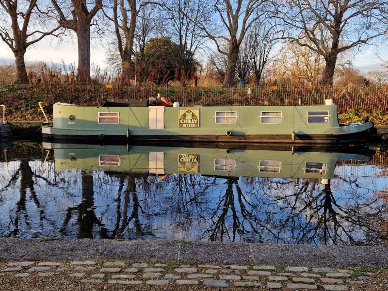
These days it would be virtually impossible for a horse to tow a barge any distance along either the Cut or the Regents because of moored boats. This also means it can be difficult to see the surface of the water when walking along the towpath but, from the opposite side of the canal there is no problem. Indeed, residential boats coming and going often offer a pleasing impression of the expression of their owner’s individuality, which they might find hard to match in a riparian residence (2).
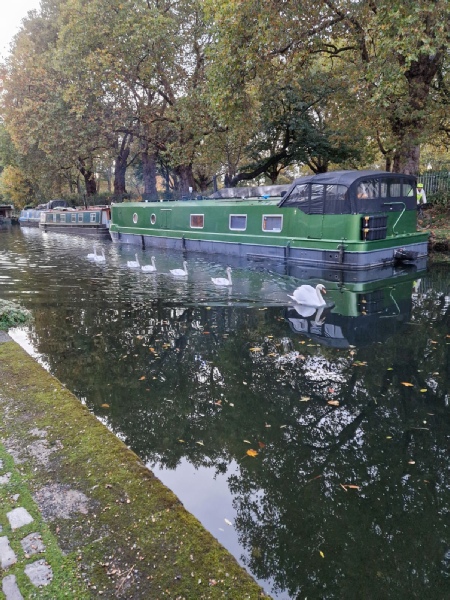
The surface of the canal path is of made of small pebbles and stones and stone blocks which are not particularly pleasant to either cycle or run on and not many people walk on them either. This must be partially due to the relatively low population density of the immediate neighbourhood. A nearby tower block is being demolished whilst the houses in the vicinity are all two storey and none of the flats rise above five. This helps give the path an open feel, its charm enhanced by the careful positioning of trees, at least one of which sports a birdbox. Most birds seem quite content with the roosting points nature offers although the stone blocks at the edge of the canal provide a perfect place to rest at the end of a long day’s dabbling or day dream about flying home to Canada (3). Sometimes a line of swans may glide by (4) their poise and elegance demanding recognition of a royal status. At one point, in the medieval period, the Crown claimed ownership of all swans in the kingdom, and even today, the King has special rights to some of the swans on certain stretches of the River Thames.
After walking further along the path you will come to a street lamp next to a tall eucalyptus tree and see a path running off right to an ornate metal chicane. As you approach this you might hear a faint tapping and wonder if a woodpecker is in the vicinity. This would be unusual and the tapping is likely to be coming from a jackhammer being used in the tower block. The path to the right, which should be taken, leads to Sycamore Avenue that in turn leads directly to Armagh Road where there was once a plaque affixed to the gable of a block of flats indicating a Roman sarcophagus had been found close by.
It is not surprising that an important artefact dating from the time of the Roman Empire was found here. Had you stood where the chicane stands in, say 126 AD, you may have been able to look across fields towards the road that ran between Londinium and Camulodunum. By this you might have seen a flock of docile sheep or a herd of anarchic goats marshalled, with difficulty, by a young goatherd. On the road itself, sometimes called the Great Road, there may have been carts piled high with hay or vegetables, pedestrians with their own burdens, the occasional rider or a unit of the Roman army setting off on a long march. By 126 AD the population of Londoninium had probably reached about 45,000 so there would have been a considerable demand for food and fodder. Before the establishment of the long period of peace known as the Pax Romana it was not unusual for areas at the sides of major Roman roads to be cleared to reduce the chance of ambush but it is likely both sides of the road between Aldgate, which was an entry point in the town’s defensive wall, and the River Lea was cultivated. It was, after all, a convenient area in which crops could be raised for an expanding market.
The River Lea has always been an obstacle to traffic going east on the north bank of the Thames and the Romans built a small fort to protect a ford that may have eventually been supplemented by a ferry and, perhaps, a bridge, although there is no trace of any structure like that built by Queen Malilda. Is it possible that Roman engineers, who had recently helped build important lines of communication and drainage in eastern Britain, were consulted about how to improve passage over the Lea and the meandering channels beyond? Impossible to say but, according to some historians, the Foss Dyke which connects two waterways, the Rivers Trent and Witham and is still in use, was constructed around this time. The influence of Roman technical advances in underwater construction were certainly felt during the C18th when the British canal network was being created. For example, when the Lune Aqueduct was being built near Lancaster, pozzalana, a material found in the volcanic areas of Italy, was imported and mixed with river sand and lime to create a mortar for use in those parts of the structure permanently under water.
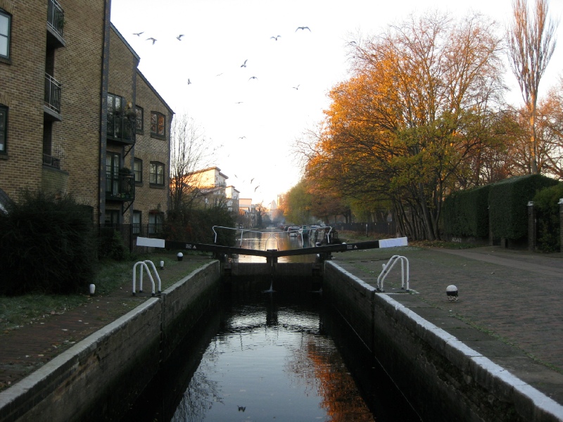
The Roman period east of Londinium is reflected in a number of street names not far from Old Ford Road, for example, Garrison Terrace, Forum Close and Roman Road itself. I am not sure if Sycamore Avenue was so named because the sycamore tree, in the view of some archaeologists, was brought to Britain by the Romans but walk into the avenue via the chicane and then take the path, dominated by a large street light, running off to the left. This leads to a car park. Keep right and follow the path round the corner until you come to a short road to the left which runs to Parnell Road. Turn left here, walk directly ahead and you will cross the canal bridge by the Top lock (5) This bridge was at first called the Homerton Footpath Bridge and was one of the original seven. After crossing the bridge you will be able to rejoin the towpath via a path to the left. On arrival note the bas-relief (6) on the old lock keepers cottage. The clog-wearing blacksmith is hard at work but does the horse look a little apprehensive to you? And spy the fish from which the globe light emerges.
The final touches to the Cut would have been made in the winter of 1829-1830, supervised by Francis Giles, a canal engineer responsible for construction since inception. Giles had gained experience under John Rennie but had undertaken work independently when a plan was drawn up to make part of the River Ivel navigable. Although he made a serious mistake in that undertaking, which lead to a considerable underestimation of costs, he was nonetheless employed to oversee construction of the Hertford Union. This eventually opened without much ceremony, there being no newspaper reports like the one in the Times at the time the Regents Canal was completed. A standard account was carried in a number of provincial newspapers, such as the Salisbury and Winchester Journal, which reported on May 3rd 1830;
A new canal has just been opened at the eastern part of London, which is intended to form a junction between the Regent’s canal and the Lea river. It is called the Lea Union canal and has been formed at the expense of an individual, Sir George Duckett.
The Dublin Evening Packet and Correspondent was a little more forthcoming about the advantages of using the new canal, drawing the attention of its readers to the fact that it would prevent the inconvenience felt in navigating in the neap-tide on the lower Lea.
There would doubtless have been some well-wishers watching as the first toll-paying boats passed through the new canal, amongst them being shareholders in the Regents Canal which stood to gain if traders began to opt to use the ‘Ducketts and Regents’ route to and from the Thames rather than continuing to ship via the Lea and the Limehouse Cut. Steps were taken to encourage these traders to use the new route through adverts in the press. It was made clear that the general conditions of transport of various bulky commodities, including coal, would follow established practices on the Lea and that ‘no charge would be made for the return of empty sacks’.
Given the successful opening of the Hertford Union perhaps many first users thought Sir George had made a shrewd investment and would soon be adding healthy profits from tolls to his other income streams. In a document prepared almost three years after the canal opened a Mr Simpson presented a very positive view. He wrote;
Indeed the importance and advantage of this Canal to all Craft using the River Lea and the Regent’s Canal is so apparent that comment is needless; it may, however, be as well to state the fact, that during First Year of opening , Tolls were received on upwards of 54,000 Tons of Goods and Merchandize, and from the rapidly increasing Trade on the Canal, it may, be safely inferred that at no very remote period the greater part of the Trade, Navigating the River Lea to and from London, and a considerable portion of the Regent’s Canal Trade, will avail themselves of this safe and short line of communication.
Unfortunately, the paragraph was in a sale document produced as a result of the collapse of a bank in which Sir George Duckett was a partner.
Hertford Union Canal
1
2
3
4
This page 3 of 5
6
When London Became An Island


5