Hertford Union Canal
Page 5 of 5
The walk so far has been in the London Borough of Tower Hamlets but you might think that as you are entering Hackney Wick you are also crossing the borough boundary into Hackney. This, however, is not the case, the towpath remaining in Tower Hamlets until the end. Across the canal is an area normally called Fish Island the reason for the name being outlined on one of the metal plates (1) dotted around the pedestrianised areas. As for it being an island it has definite boundaries that more or less cut it off from adjacent areas. Its shape is triangular, bounded by the canal and the river on two sides and the great embankment built for the Northern Outfall Sewer on the third. Some people who lived there in the industrial era might have spoken of living on Fish Island and this makes sense - even more so when it is recognised that there are no fishy streets on the towpath side of the canal. Today Fish Island might be referred to in a way that implies it is a sub area of Hackney Wick or, alternatively, that it is a separate entity but this is nothing to loose sleep over.
Had things worked out rather differently Fish Island may have been occupied by a substantial Victorian gasworks similar to the one built not far away near Johnsons lock on the Regents Canal. However, the gas company changed its plans and built the gasworks elsewhere, so the land was developed for factories and attendant terrace housing. As in Hackney Wick the rows of terrace houses were generally two storey and many had a small yard at the back. Heating was by coal so on cold days the air was smokey, the smell of the burning fuel mixing, depending on the wind, with those generated in local factories. Over the years a wide variety of industries were domiciled hereabouts and every day thousands of workers would make their way to premises manufacturing all kinds of products including paint, oil derivatives, dye stuffs, shellac, sweets and, although for two years only, the world’s first true synthetic plastic, parkesine.
All the terrace houses in Fish Island have now gone and although some vintage industrial buildings remain they lurk in the peripheral areas, the canalside and central parts being dominated by modernity. The layout of the streets has not, however, changed and nor have the names, which is apt given that the area must, surely, be regarded as part of the present push towards ‘Blue Urbanisation’. Originally this term referred to the link between cities and oceans but as it now encompasses the redevelopment of river and canal side areas surely Fish Island must be included. Fish need water after all.
The current development of Fish Island started earlier than on the towpath side of the Cut (which appears to be called Wickside) and it now has a number of thriving bars, cafes and restaurants. There is also a bookshop overlooking the canal which I trust everyone hopes will become a focal point of community life having made a good start with a series of regular events. Not all enterprises succeed in a ‘starting from scratch’ situation and one that fell by the wayside was Barkney Wick (2) which, as the advert said, was for dogs and humans. Barkney Wick provided a facility for looking after dogs during the working day but although there seem to be plenty of dogs in the area the venture apparently failed. Even so the fact that it was established in the first place indicates the spirit of business entrepreneurship (with the risk that inevitably brings) is thriving on Fish Island and should be saluted.
The Bottom lock, the third and last lock of the Cut, is only a short distance from the concrete bridges. The lock itself has a much lower fall than either the Top or Middle locks and the short gates look rather curious. However, until recently, it was the nearby brick walls that drew attention as they became a display board on which artists producing ‘spray painted graffiti visuals’ could work. I borrowed that description from the website of Silent Hobo who, in the early summer of 2017 produced a mural on the largest of the flank walls. I didn’t manage to get a picture of this before it was partly painted over but, even at that stage, much of the work was clearly visible. Then, over the next couple of weeks, most of the mural was obliterated by the work of other spray can specialists who made their own, short-lived contributions. Click here to see the work of artists on the lockside walls.
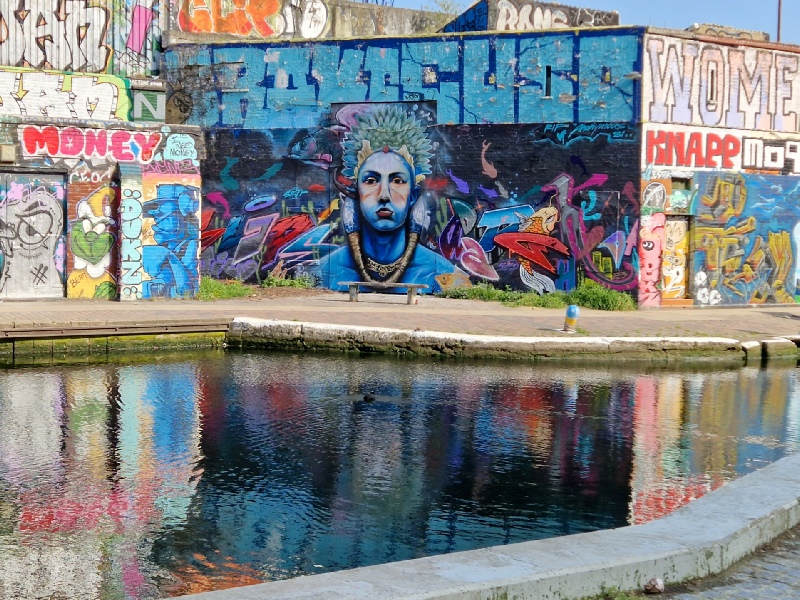
The artists (not to be confused with those anti-social sprayers who aimlessly disfigure the lock gates and bridges) who worked by the lock week after week seemed to accept their creations would be transient so treated the walls as a great, free canvas. Once created, their work may have been photographed for inclusion in a portfolio and then, like Silent Hobo, the artist stood aside to let the cycle continue. Photograph 3 was taken a few days before one wall was replaced by wooden hoardings, so no wonder the figure looked blue. Perhaps it reflected the view of the artist on the term Blue Urbanisation. Fortunately, it would appear that, perhaps, not all is lost because one wall looks as though it might be retained.
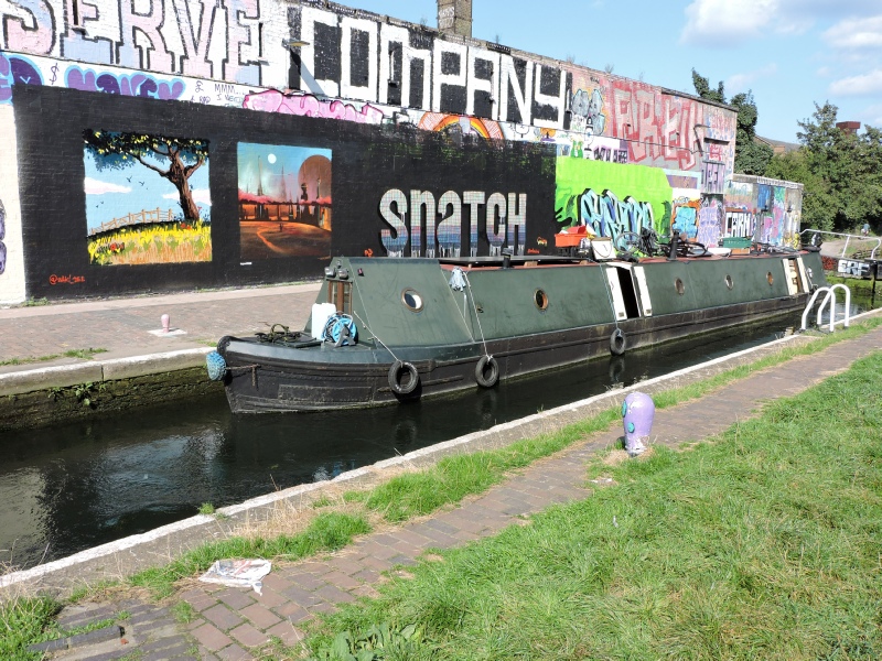
The relatively quick change of nearby graffiti visuals meant there was always something new at the Bottom lock to catch the eye but those who preferred to look for evidence of more traditional canal life might just have observed passing boats. I always find it surprising how many working narrow boats have survived after having been converted for leisure use or simply to provide a floating home. The boat shown in photo 4, for example, was built just over a century ago.
A few yards beyond the Bottom lock the towpath becomes a little wider and there are some small cultivated plots. It is too early to tell what the towpath will be like once all developments have been completed, but perhaps some enhancement of the banks by a selection of growing plants will be encouraged. At the moment it can all seem a bit barren. Click here to see views of the canal around the lock taken in 2016 and 2026.
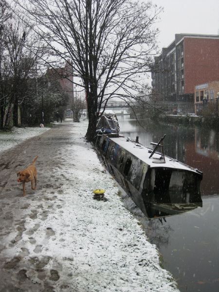
There was a bridge at the end of this stretch of the towpath, shown in photograph 5 and also taken ten years ago. If you were tempted to cross it on a frosty morning you had to take care as it could be rather slippy underfoot. Like the old brick walls that bridge has gone is so let’s hope the one that has replaced it has been built with a less tricky surface.
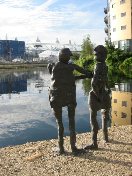
You will now be near the end of the Cut where you might see a number of small metal sculptures (6), which, like the London Stadium across the water, date from 2012. If you arrive when a match is being played you might, just, hear the distant roar of the crowd. Some of the older residents of Hackney Wick may well remember similar roars when activity was based in another London Stadium, which stood nearby. Greyhound racing and speedway took place there and had a strong local following. Both sports generated great enthusiasm and the venue continued to be used until the late 90s when financial problems led to its closure. Within a few years the place was derelict and was eventually demolished, the site then being used for new buildings needed by the Olympics.
At this point the excursion ends but although dwelling on ‘what might have been’ is a bit pointless I think it is worth reflecting for a moment on what Sir George Duckett’s full vision might have brought had it been realised. If the Stort to Cam link had been built then it would have provided such a valuable addition to the canal network it might well have survived the arrival of the railways and the decline of the C20th. So Limehouse to Lynn via Bishops Stortford and Cambridge could have provided a slow but delightful journey right to the present day.
Should you wish to explore on the opposite side of the river, either north or south, then follow the path round, turn right, cross the bridge and go right again. The riverside area has become very popular as a social venue over the past few years.
By going south from here it is possible to reach Limehouse Basin via Three Mills and the Limehouse Cut towpath. However, if you want to return to the Regents Canal (and don’t wish to simply turn round and walk back the way you came) you could use public transport. If you Have crossed the bridge and are on the towpath of the Lee Navigation keep walking to the next bridge and then make your way up to the road which it carries. You will see a bus stop where you can catch a 339 which will drop you at St Barnabas Church (stop Y), close to the junction of Grove Road and Roman Road. The Regents Canal passes under Roman Road close by so you may continue your walk along the Regents to Limehouse.
Go to
When London Became An Island


6
5
3
2
1
4